Aupaumut's Travels, Inset
This map is an inset of the territory on the Maumee and Auglaize Rivers through which Aupaumut traveled, showing the locations of the "Rapids" and the "Forks" where major councils were held, along with the locations of Algonquian villages where he visited, camped, and participated in council.
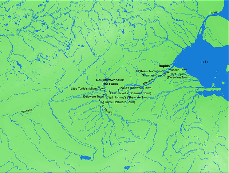
Click on map to see enlarged image.