Ohio Valley Boundary Lines
This map shows the territory of the United Indian Nations, with the original "Ohio River" boundary line established by the Fort Stanwix Treaty of 1768 and Brant's proposed compromise boundary line on the Muskingum River, which would serve as a border between the newly established United States and the United Indian Nations.
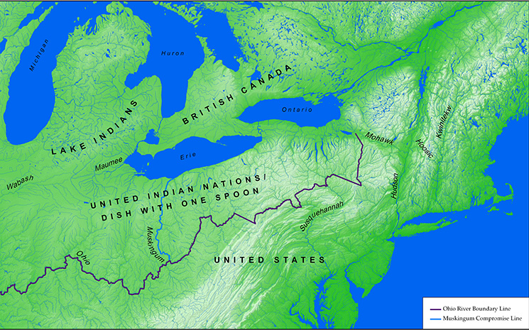
Click on map to see enlarged image.