Kwinitekw (close up)
This map shows the river Kwinitekw from Ktsipontekw, the Sokoki "great falls," to Peskeompscut, the Pocumtuck "great falls," with Native wôlhanak ("hollowed out places" or intervales) highlighted. Note the mountains (Hoosic range and Mount Wachusett) that form geographic and political boundaries between territories, and the location of colonial fort settlements within Native space.
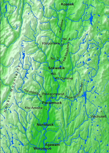
Click on map to see enlarged image.