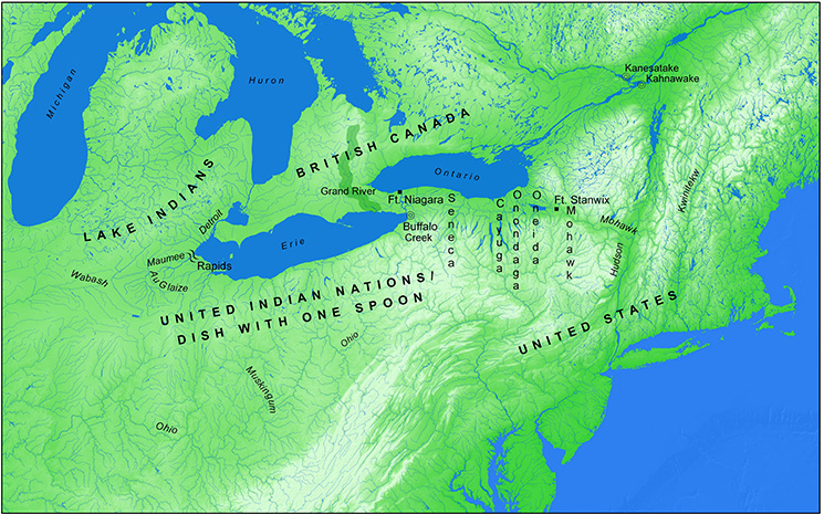
Ohio Valley: The Dish with One Spoon
This map shows the Ohio Valley according to Joseph Brant's description of the Dish with One Spoon, demonstrating the spatial conceptualization of the territory of the United Indian Nations, with the Haudenosaunee Confederacy and the United States to the east, British territory to the north, and the territory of the Three Fires or "Lake Indians" to the northwest. Also shows the locations of places mentioned in Chapter 3, with Brant's village of Grand River highlighted.
Some areas of the map above can be clicked to navigate to other maps.
Click here for enlarged image.