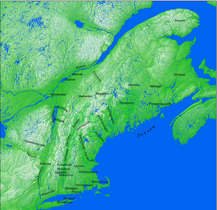
Kwinitekw Environs
This map expands from the previous one to the larger network of Kwinitekw, showing Wabanaki wôlhanak, mission villages, and neighboring Native territories from Sobakw, the sea, to Ktsitekw, the St. Lawrence River.
Some areas of the map above can be clicked to navigate to other maps.
Click here for enlarged image.